Search
Now showing items 1-5 of 5
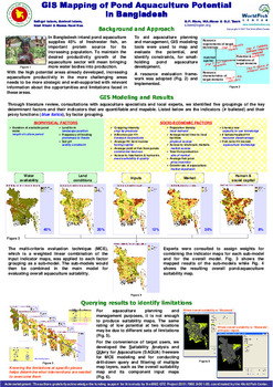
GIS mapping of pond aquaculture potential in Bangladesh
Type: Brief
In Bangladesh inland pond aquaculture supplies 45% of freshwater fish, an important protein source for its increasing population. To maintain the desired productivity growth of the aquaculture sector will mean bringing ...
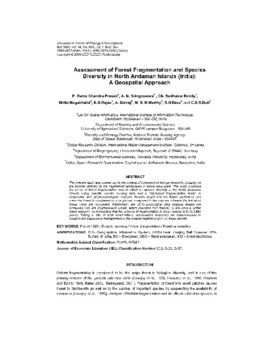
Assessment of forest fragmentation and species diversity in North Andaman Islands (India): a geospatial approach
Type: Journal Article
The present study was carried out in the context of conservation biology research, focusing on the species diversity in the fragmented landscapes of island ecosystem. The study analyzed the levels of forest fragmentation ...
From global to local: testing the potential of cross-scaling in global data sets
Type: Journal Article
The present study investigates the potential of readily available and easily accessible global data sets to understand regional/local level interactions in wetland systems. The biogeographical zones of India were used a ...
Remote sensing application to study the aquaculture dynamics in Kolleru Lake, India
Type: Conference Paper
Kolleru lake, India’s largest fresh water lake, and lone Ramsar site in Andhra Pradesh state have undergone tremendous changes due to development of aquaculture. Large-scale aquaculture practices, increased industrial ...
Mapping Indian inland fish diversity using histoical occurrence data in Fishbase
Type: Report
Fish museums across the world are a repository of historical data on fish abundance and occurrence. These occurrence points when mapped provide a picture of present-day and earlier fish distribution. The accuracy of the ...