Search
Now showing items 1-3 of 3
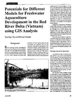
Potentials for different models for freshwater aquaculture development in the Red River Delta (Vietnam) using GIS analysis
Type: Journal Article
This study was an attempt to apply land-based GIS analysis for freshwater aquaculture planning in the Red River Delta of Vietnam. It was based on diverse data sources in order to help decision makers at the site and also ...
MAPPER, a low-level geographic information system
Type: Journal Article
A Low-Level Geographic Information System (LL-GIS) was developed to provide a simple low-cost mapping program which can be executed in any personal computer, by individuals with different levels of knowledge in computing. ...
A low-level geographic information system for coastal zone management with applications to Brunei Darussalam: Part III:: simulation and tracking oil spills
Type: Journal Article
B:RUN is a low-level GIS software designed to help formulate options for the management of the coastal zone of Brunei Darussalam. This contribution presents the oil spill simulation module of B:RUN. This simple module, ...